The summit of Xi Luoyu spans three counties with a single step丨西骆峪之顶 一脚踏三县
骆峪又称西骆峪,古名骆谷,因黄帝三子骆明建立骆峪国而得名。位于秦岭北麓陕西省周至县西南15千米骆峪乡境内,距离西安约110千米。
Luoyu, also known as Xi Luoyu, was historically called Luo Valley, named after Luo Ming, the third son of the Yellow Emperor, who established the Luoyu State. It is located in the Luoyu Township, 15 kilometers southwest of Zhouzhi County in the northern foot of the Qinling Mountains, Shaanxi Province, approximately 110 kilometers away from Xi'an.
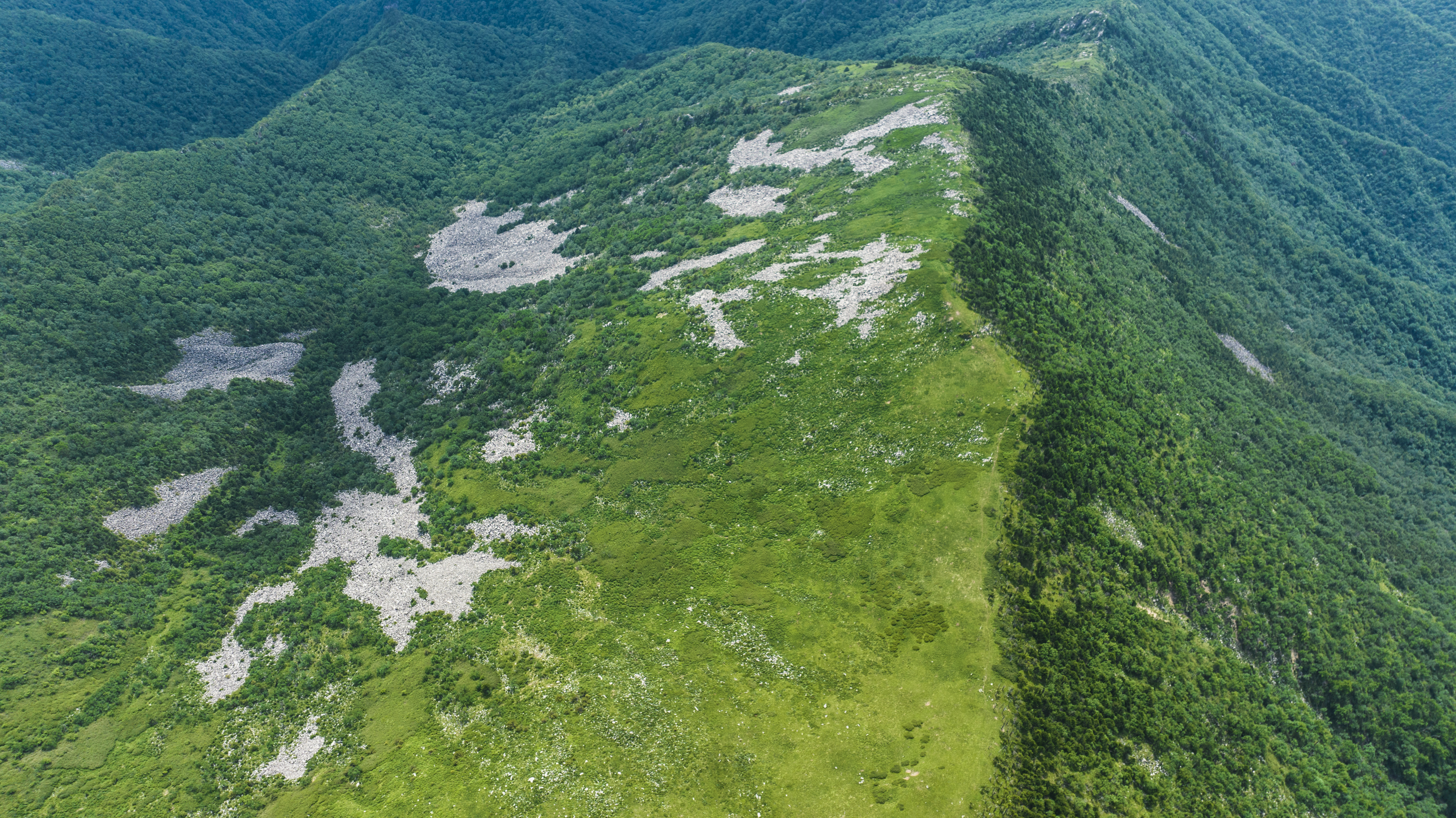
(俯瞰“一脚踏三县”)
(Overlooking "One Step Across Three Counties")
西骆峪是相对东骆峪而言的,是古代通往南方的傥骆古道。在中国历史上,穿越秦岭的诸条古栈道中,傥骆古道最靠近秦岭主峰太白山,途中要翻越太白山周围的五六座分水岭,人烟稀少猛兽出没。
Xi Luoyu, in contrast to Dong Luoyu, refers to the ancient Taoluo Ancient Road, which was a passage to the south. Among the various ancient plank roads that traversed the Qinling Mountains in Chinese history, the Taoluo Ancient Road was the closest to the main peak of the Qinling, Mount Taibai. The journey required crossing five or six watershed ridges around Mount Taibai, which were sparsely populated and frequented by wild beasts.

(西骆峪山脊上,有大量的第四纪冰川遗迹)
(On the ridge of Xi Luoyu, there are numerous remnants of the Quaternary glaciers)
尽管如此,傥骆古道还是通往南北的首选道路有史料记载,在三国时期,刘备在汉中建立了对付曹魏的军事基地,傥骆古道是通北的首选道路。中唐以后,成为官道,官员任免,回京述职,多走此路,路上遍布亭帐馆舍,以备军旅之用。自明代以后,因为奇险而疏于使用。
Despite this, the Taoluo Ancient Road was still the preferred route for north-south travel. Historical records indicate that during the Three Kingdoms period, Liu Bei established a military base in Hanzhong to counter Cao Wei, and the Taoluo Ancient Road was the preferred route to the north. After the middle of the Tang Dynasty, it became an official road, with officials traveling to and from the capital for appointments and reports, and the road was lined with pavilions, tents, and lodgings for military use. Since the Ming Dynasty, it has been neglected due to its treacherous nature.
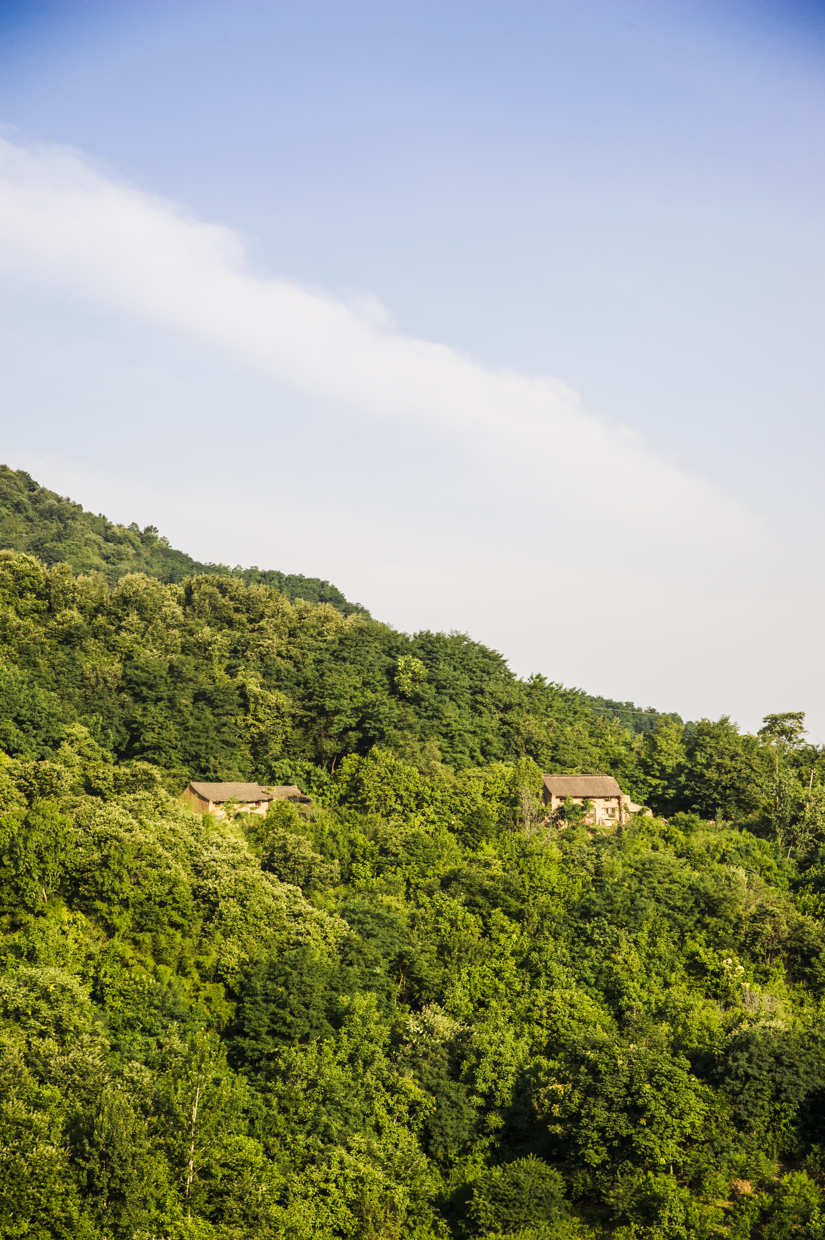
(入口尚存的老式民居,现基本无人居住)
(The old-fashioned residences, which were once populated, are now virtually uninhabited)
因为西骆峪有着重要的古道南北通往捷径,据说60年代末70年代初,我国在修建西安通往汉中的战备路时,首选了这条线路,也就是如今称之为“老周佛路”的路(周至-佛坪)。
Because Xi Luoyu has an important shortcut for north-south passage, it is said that at the end of the 1960s and the beginning of the 1970s, when our country was building a strategic road from Xi'an to Hanzhong, this route was chosen first, which is now known as the "Old Zhoufo Road" (Zhouzhi-Foping).

(这样的石头犹如一夫当关,横在老周佛路上)
(Such stones stand like a lone guardian at a pass, blocking the Old Zhoufo Road)
可惜的是“老周佛路”是一个半途而废工程,有说是基于山高险峻,风险大,不断有伤亡发生,而中途放弃,从新选址为黑河,沿着河床往南进入佛坪,也就是人们现在所走108国道。老周佛路当时已修建好近40余公里,废弃之后作为林场路使用。
Unfortunately, the "Old Zhoufo Road" was an unfinished project, some say it was abandoned halfway due to the high mountains and steep risks, with continuous casualties, and a new site was chosen along the He River, entering Foping along the riverbed, which is now the National Highway 108 that people travel. The Old Zhoufo Road had already been constructed for nearly 40 kilometers at the time and was used as a forest farm road after being abandoned.
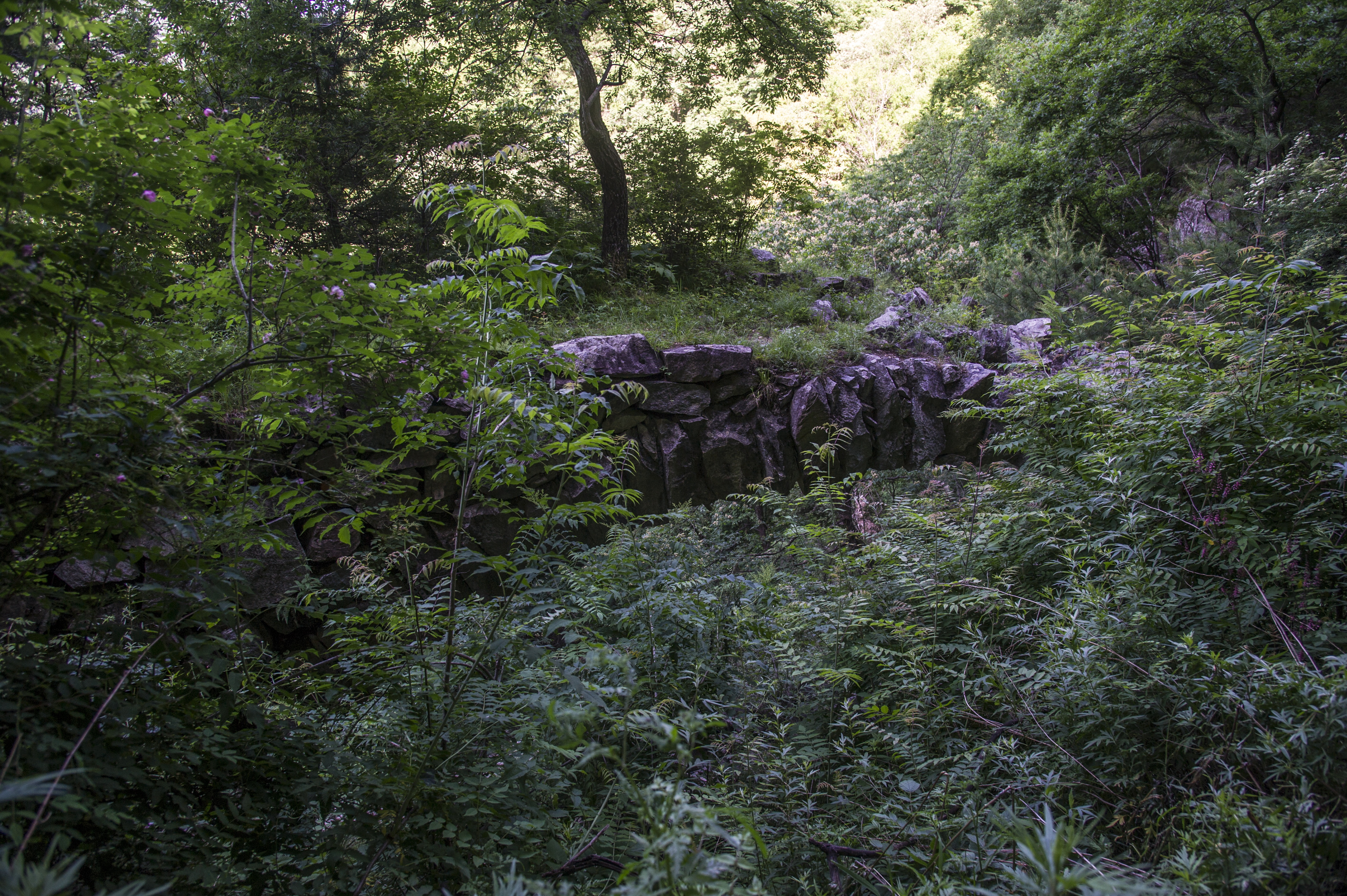
(老周佛路基本都修建在石崖上,其中有一处石桥还残存着)
(The Old Zhoufo Road is mostly constructed along the cliffs, with one stone bridge still partially remaining)
2018年,我国普及村村通公路,因为里边有一个村子,部分路面得到硬化,还安装了护栏。如今秦岭生态环境保护,周至县永红林场在进山处修建了站卡,只有获悉批准才可进入。
In 2018, with the country's popularization of roads to every village, some of the road surfaces were paved and guardrails were installed because there was a village inside. Nowadays, for the protection of the Qinling ecological environment, the Yonghong Forest Farm in Zhouzhi County has built a checkpoint at the entrance of the mountain, and only with approval can one enter.
过去,这里的山区植被遭受严重破坏,但近年来,通过封山育林,次生林和灌草植被得以恢复,源头附近的生态环境依然保持原始状态,植被丰茂,野生动物频繁出没。
In the past, the vegetation in this mountainous area was severely damaged, but in recent years, through the closure of mountains for afforestation, secondary forests and shrub vegetation have been restored, and the ecological environment near the source has remained in its original state, with lush vegetation and frequent wildlife.

(这里是动物王国,羚牛的天堂,它们在这里悠闲散步吃草)
(This place is an animal kingdom, a paradise for goral, where they leisurely stroll and graze)
车行进30公里,再步行5公里左右,便开始爬山3公里,即可到达传说中的“一脚踩三县”,周至、眉县、佛坪,实际上一脚踩三县是一个古老的传说,在现今的行政版图上只是周至县和眉县,佛坪县据说在民国版图上是在这里的,也就是当时的佛坪厅,现在的周至县老县城村。
After driving for 30 kilometers and walking about 5 kilometers, you start to climb a mountain for 3 kilometers to reach the legendary "one step across three counties," Zhouzhi, Mei County, and Foping. In fact, "one step across three counties" is an ancient legend. On today's administrative map, it is only Zhouzhi County and Mei County. It is said that Foping County was here on the map of the Republic of China, that is, the Foping Hall at that time, now the old town village of Zhouzhi County.

(一脚踏三县的导航架标志,海拔2824米)
(The navigation frame marker for "One Step Across Three Counties," at an altitude of 2824 meters)
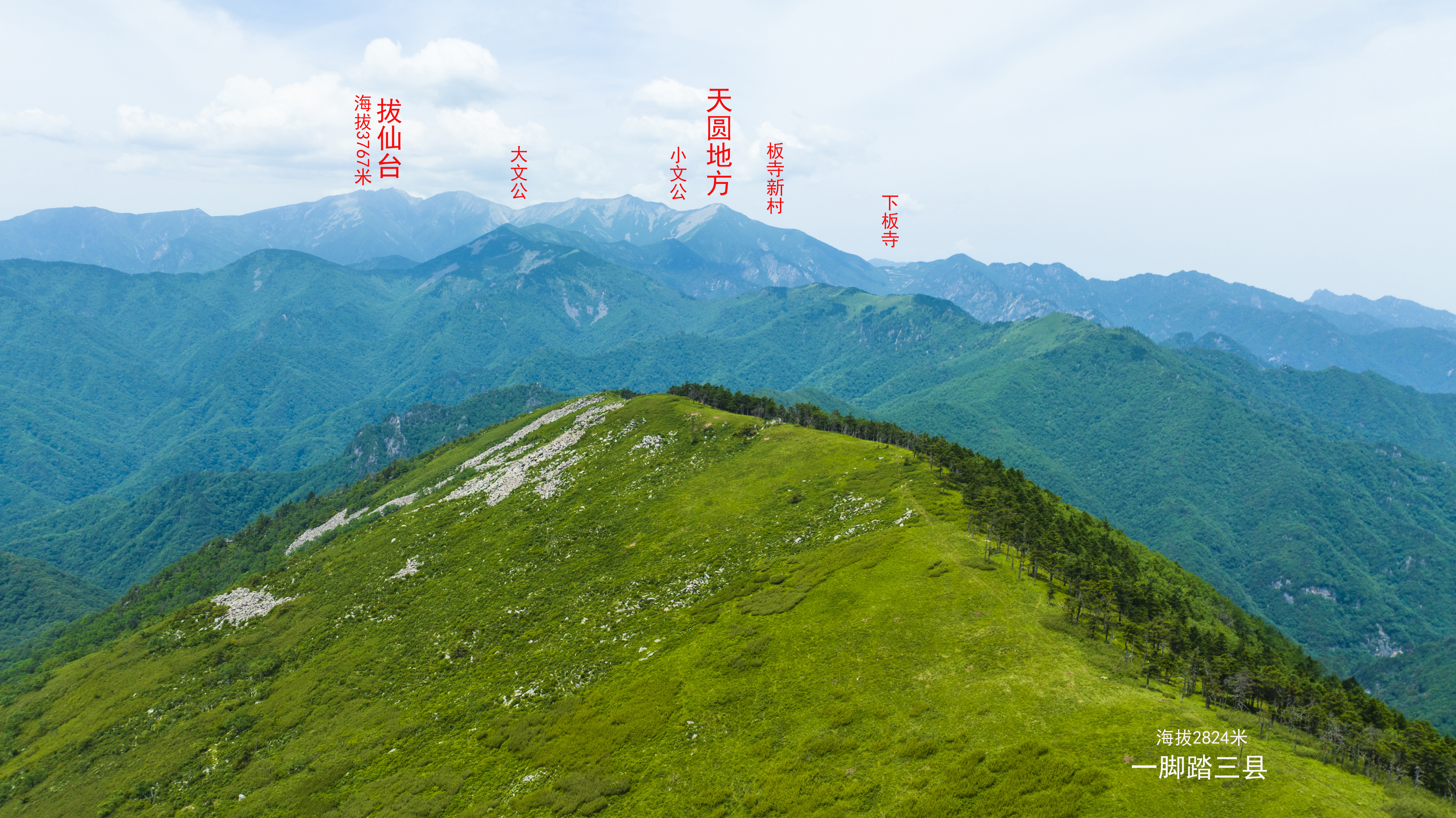
“一脚踏三县”海拔2824米,与17公里外的海拔3767米的太白山拔仙台遥遥相望,是一个观太白大梁之巅的绝佳之地。
"One step across three counties" is at an altitude of 2824 meters, facing the 3767-meter-high Ba Xian Terrace of Mount Taibai, 17 kilometers away, and is an excellent place to view the top of the Taibai Ridge.
华商报大风新闻记者 李杰/图 王煜鑫/文 实习生 李冉 张钰檬/翻译
来源:华商国际传播中心
编辑:邓波
相关热词搜索:
上一篇:Be raging like a storm · Qinling Fengyu Moutain丨 探青山看秦岭 风起云涌·秦岭风雨山


